Nampula
Nampula is the capital city of Nampula Province in Northern Mozambique. With a population of 743,125 (2017 census), it is the third-largest city in Mozambique after Maputo and Matola. The city is located in the interior of Nampula Province, approximately 200 kilometers from the coast and is surrounded by plains and rocky outcrops. The city is a major regional centre for the entire Northern region of Mozambique, as well as parts of Central Mozambique and border areas of Malawi and Tanzania.
The city links the port city of Nacala with land-locked Southern African countries, particularly Malawi through a road and railway line. The city has a small international airport connecting to Nairobi in Kenya, Johannesburg in South Africa, Dar-es-Salaam in Tanzania and is a hub for local transport in northern Mozambique. Nampula is the centre of business in Northern Mozambique, benefitting from highly productive agricultural areas, proximity to the Nacala Development Corridor, and a fast-growing city population.
Nampula is home to the Mozambican National Ethnographic Museum, several markets, cathedrals, mosques, universities, training institutes and schools. The city is diverse, with the native eMakhuwa population being the largest group but with a visible Indian, European, Chinese, Lebanese, Somali, and Nigerian population.
The name "Nampula" is said to be derived to the eMakhuwa word "Whampula", which according to local legend refers to a tribal leader of the area in the past.
Map - Nampula
Map
Country - Mozambique
 |
 |
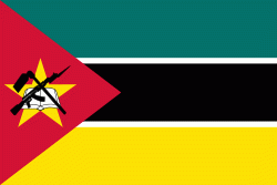
| Flag of Mozambique | |
Notably Northern Mozambique lies within the monsoon trade winds of the Indian Ocean and is frequentely affected by disruptive weather. Between the 7th and 11th centuries, a series of Swahili port towns developed on that area, which contributed to the development of a distinct Swahili culture and dialect. In the late medieval period, these towns were frequented by traders from Somalia, Ethiopia, Egypt, Arabia, Persia, and India.
Currency / Language
| ISO | Currency | Symbol | Significant figures |
|---|---|---|---|
| MZN | Mozambican metical | MT | 2 |
| ISO | Language |
|---|---|
| PT | Portuguese language |


